Marine-Maritime
Translate


Mercator sailing
Mercator sailing provides a mathematical solution of the plot as made on a Mercator chart. It is similar to plane sailing, but uses meridional difference and difference of longitude in place of difference of latitude and departure.
Mercator chart
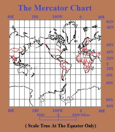
Mercator Chart
Straight lines on this projection are lines of constant compass bearing.
• The Mercator is also a "conformal" map projection. This means that it shows shapes pretty much the way they appear on the globe.
• You cannot show both shape and size accurately. If you want a true shape for the land masses you will necessarily sacrifice proportionality, i.e., the relative sizes will be distorted.
MERCATOR SAILING
Mercator sailing problems can be solved graphically
on a Mercator chart. For mathematical solution, the
formulas of Mercator sailing are:
tan C = Dlo /m
Dlo= m . tan C.
After solving for course angle by Mercator sailing,
solve for distance using the plane sailing formula: D = l sec C
Mathematical solution for finding course and distance on a mercator projection.
It is similar to plane sailing, but uses meridional difference and difference of longitude in place of difference of latitude and departure.
Can also be done by charting on a mercator chart, but the mathematical solution is more precise than chartwork can be.
Customary to record results to these precisions; D and C to 0.1', Cn to 0.1ᴼ.
If used to predict destination L/Lo, can have appreciable error in DLo if course is near 090ᴼ or 270ᴼ , so not used for courses due east or west (Dutton's 15th, article 3104 quoted 280ᴼ ; but I think that should have read 270ᴼ)
Use parallel sailing in those cases.
Yields rhumb line solutions.
Terms and Definitions
In solutions of the sailings, the following quantities are used:
1. Latitude (L). The latitude of the point of departure is designated Ll; that of the destination, L2; middle (mid) or mean latitude, Lm; latitude of the vertex of a great circle, Lv; and latitude of any point on a great circle, Lx.
2. Mean latitude (Lm). Half the arithmetical sum of the latitudes of two places on the same side of the equator.
3. Middle or mid latitude (Lm). The latitude at which the arc length of the parallel separating the meridians passing through two specific points is exactly equal to the departure in proceeding from one point to the other by mid-latitude sailing. The mean latitude is used when there is no practicable means of determining the middle latitude.
4. Difference of latitude (l or DLat.).
5. Meridional parts (M). The meridional parts of the point of departure are designated Ml, and of the point of arrival or the destination, M2.
6. Meridional difference (m).
7. Longitude (l). The longitude of the point of departure is designated l1; that of the point of arrival or the destination, l2; of the vertex of a great circle, lv; and of any point on a greatcircle, lx.
8. Difference of longitude (DLo).
9. Departure (p or Dep.).
10. Course or course angle (Cn or C).
11. Distance (D or Dist.).